Auteurs:
Lictevout, E.; Abellanosa, C.; Maass, C.; Pérez, N.; Yáñez, G.; Leonardi, V.; Septembre 2020. Pag. 529-558
Année 2020 | 30 pages | ANGLAIS
Publié par Andean Geology Vol. 47, No. 3 – Septembre 2020.


Auteurs:
Lictevout, E.; Abellanosa, C.; Maass, C.; Pérez, N.; Yáñez, G.; Leonardi, V.; Septembre 2020. Pag. 529-558
Année 2020 | 30 pages | ANGLAIS
Publié par Andean Geology Vol. 47, No. 3 – Septembre 2020.
In arid areas, the efficient management of scarce water resources is key for population survival and development. One of the oldest and greatest ancient water management system in drylands is the filtration gallery. Originated from ancient Persia, they were spread to other regions and cultures, and are found in the oasis of Pica, in the Atacama Desert. A filtration gallery consists of an almost horizontal tunnel dug underground until it reaches a water-bearing zone. It allows to tap and drains out groundwater, and thus a direct contact with groundwater table. With the objective to understand groundwater processes, preserve the water and geoheritage of one of the driest places on Earth and improve land-use planning, the present work explored and studied the filtration galleries, locally called socavones, of the oasis of Pica. Through direct exploration, topographical survey and geo-electrical prospection, 24 socavones were identified, mapped and their main physical features described, showing common traits with filtration galleries described worldwide, but also proper features highlighting their originality. The findings of the geological and hydrogeological studies of the socavones, complemented by physical and chemical analysis, allow to identify new groundwater recharge processes and, thus, to review and complete the hydrogeological model of the local aquifer of Pica. Most socavones are abandoned today, owing to physical and socioeconomic changes. Nevertheless, this study concludes that they can still have a role to play in the groundwater management of this arid area.
Keywords: Filtration gallery | Arid area | Groundwater recharge | Pica aquifer | Water and geoheritage | Northern Chile

Auteurs:
Santos A., Figueroa A, Iturraspe R., da Silva García A., Sterh A., Urciuolo A., Lictevout E., Vásquez C., Habit E. Décembre 2019. Pag. 37-43
Année 2020 | 62 pages | ESPAGNOL – ANGLAIS
Cet article est un chapitre de la publication: Koleff, P., Figueroa, A., Saavedra, B., Rojas, C., Lehm, Z., Tironi M., et. al (2019). Biodiversidad, Género y Cambio Climático: Propuestas basadas en conocimiento. Iniciativa Latinoamericana y el Caribe. Santiago de Chile. [Corporación Capital Biodiversidad].
Aquatic ecosystems in Latin America and the Caribbean play a fundamental role in climate change resilience. Deforestation, overconsumption of water in a context of shortage and pollution loads from the use of fertilizers, are problems that reduce resilience and are determining factors in biodiversity loss, deepening social and gender gaps. Sustainable management, Nature-based Solutions and conservation with a gender perspective should be the priority axes of climate change adaptation programs.
Keywords: water | ecosystems | climate change | nature-based solutions | Latinamerica

Auteurs:
Donoso G., Lictevout E., Rinaudo JD. (2020) Groundwater Management Lessons from Chile. In: Rinaudo JD., Holley C., Barnett S., Montginoul M. (eds) Sustainable Groundwater Management. Global Issues in Water Policy, vol 24. Springer, Cham
Année 2020 | 28 pages | ANGLAIS
Cet article est un chapitre du livre: Sustainable Groundwater Management.
Groundwater has increasingly become a water supply source in Chile. In the future this trend is expected to grow as a consequence of the increased water use due to economic growth, together with population growth, urbanization, water contamination and pollution, as well as the projected climate change impacts. The Water Code of 1981, as well as previous water codes, were in essence designed for surface water and, thus, contained only few references to groundwater. This regulatory absence has been covered with groundwater guidelines established through internal administrative acts. As it stands, the legal and institutional context considers the required instruments and mechanisms to balance growing demand and the need to protect and preserve groundwater resources. This chapter investigates whether this framework has been effective to ensure that groundwater is managed sustainably, through the analysis of two cases located in an arid region of northern Chile: the Copiapó Valley and the Pampa del Tamarugal Aquifer.
Keywords: groundwater governance | groundwater management | collective groundwater management | groundwater communities | Chile

Auteurs:
– Elisabeth Lictevout: Universidad de Concepción, Concepción, Chile; and Carpe Science, San Pedro de la Paz, Chile.
– Nicolas Faysse: G-Eau research unit, Cirad, Montpellier University, Montpellier, France; and Asian Institute of Technology, Bangkok , Thailand.
Année 2018 | 15 pages | Format PDF | 0,9 Mb | ANGLAIS
In northern Chile groundwater resources are used intensively for mining activities, drinking water and agriculture. This article analyses the groundwater management in the Pampa del Tamarugal Aquifer, paying special attention to the links between (a) how information relating to groundwater resources and its uses is applied to management and (b) actors’ strategies and discourses on groundwater management. The analysis focuses on two moments: the decision to stop issuing new water rights and the short-lived experience of a regional water resources research centre. Actors never actually discussed an appropriate groundwater pumping rate and some used groundwater resources as a means of pursuing strategies that were not related to water management per se. Many called for a participatory process to allocate water for different uses, although this would entail changes to Chilean legislation. Such a process would help the Pampa del Tamarugal Aquifer become more ‘visible’ and could trigger genuine discussion about the status and use of groundwater resources.
Keywords: Groundwater management | hydrogeological assessment | Pampa del Tamarugal | Chile
Auteurs:
-Elisabeth Lictevout (corresponding author): Facultad de Ciencias Forestales, Universidad de Concepción, Calle Victoria 631, Concepción, Chile.
– Martin Gocht: Technische Universität Braunschweig, Universitätsplatz 2, Braunschweig 38106, Germany
Année 2017 | 13 pages | Format PDF | 0,5 Mb | ANGLAIS
Efficient water management needs hydrological information provided by hydrometric networks. In arid and mountainous regions, hydrologic models for water resources management and forecasting require a large amount of data due to the temporal and spatial heterogeneity of hydrometeorological variables. The interaction of complex oceanic and atmospheric circulations makes North Chile one of the world’s most arid areas. Since the onset of large mining projects in the nineties, constant population and economic growth generates high pressure on water resources. The existing regional scale hydrometric network in Tarapacá allows for the description of general characteristics and trends at national, but not at water basin level and therefore does not meet actual demands. Methods for hydrometric network design were designed for temperate areas in general. Based on a review of existing methodologies, the paper identifies multi-criteria analysis (MCA) as best adaptable to the context. It develops a methodology for hyper-arid areas, complementing MCA with stakeholder and geographic information system (GIS) analysis, as well as optimization. The paper optimizes the existing hydrometric network in the Tarapacá region, characterized by strong constraints regarding access and topography. Three MCA techniques are compared. The result is an optimized network consisting of 36 rainfall and 21 streamflow stations.
Key words: arid | hydrometry | multi-criteria analysis | rain gauge | stakeholder | streamgauge
Auteurs:
– Elisabeth Lictevout
– Constanza Maass
– Damián Córdoba
– Venecia Herrera
– Reynaldo Payano
– Jazna Rodriguez
– Jose Aguilera
Année 2013 | 9 pages | Format PDF | 3,2 Mb | ESPAGNOL-ANGLAIS
La Región de Tarapacá, localizada en el extremo norte de Chile, es una de las zonas más áridas del mundo, parte del desierto de Atacama. El contexto geográfico, climático, geomorfológico y geológico le confieren características hidrológicas e hidrogeológicas únicas que generan ambientes evaporíticos (salares) y acuíferos con recarga alóctona que representan el único recurso permanente. Desde la décadas de los noventa, con la instalación de los grandes proyectos de minería, el crecimiento poblacional y económico de la región ha generado una fuerte presión sobre los recursos hídricos, aumentando la demanda hídrica cual, en la actualidad, es mayor a la disponibilidad, dando pie a escenarios de competición y conflictos entre usuarios. En zona árida, la heterogeneidad temporal y espacial de las variables hidrometeorológicas y la complejidad de los procesos hidrológicos e hidrogeológicos involucrados requieren disponer de una cantidad más importante de datos, tanto espacial como temporalmente, para generar modelos hidrológicos e hidrogeológicos predictivos. La Dirección General de Aguas (DGA) es la institución mandatada por el Estado para operar y mantener una red de monitoreo hidrométrica de escala regional. Esta red genera datos que permiten describir las características generales de los recursos hídricos y tendencias principales pero no permite una caracterización al nivel de cuenca o masa de agua. Los datos registrados presentan deficiencias tanto en cantidad como en calidad. Las carencias al nivel espacial y temporal, así como las deficiencias en la representatividad y fiabilidad de los datos no permiten tener un conocimiento suficiente de la situación de los recursos hídricos, cuantificarlos y predecir su evolución. Por consiguiente, actores privados han desarrollado su propia red hidrométrica y sus propios estudios respondiendo a objetivos sectoriales y locales. Generan una cantidad de datos no despreciable. Además, en Chile, se han registrado 43 organismos vinculados con la gestión del agua. Así, la información sobre los recursos hídricos es dispersa y de difícil acceso. En este contexto de incertidumbre en cuanto al nivel de conocimiento e información existente sobre los recursos hídricos de la región, el Centro de Investigación y Desarrollo en Recursos Hídricos (CIDERH) de la Región de Tarapacá generó un diagnóstico de la información hídrica existente, en base a una recopilación, sistematización y análisis de los datos y estudios existentes. Los principales productos son un análisis crítico y una herramienta de gestión y transferencia de la información. El análisis integral de todos los datos generados en la zona, tanto por actores públicos como privados permite reducir la incertidumbre de los estudios y modelos. Compartir esta información en una plataforma de gestión de la información permitiría optimizar recursos y mejorar la gestión conjunta de los recursos hídricos. En este contexto, mejorar el conocimiento de los recursos hídricos constituye una precondición a su gestión eficiente y por ende al desarrollo sostenible de la región.
Palabras clave: Recursos hídricos | zona árida | Región de Tarapacá | diagnóstico | red de monitoreo hidrométrica | gestión
del agua
Auteurs:
– Elisabeth Lictevout
– Constanza Maass
– Damián Córdoba
– Venecia Herrera
– Reynaldo Payano
Année 2013 | 226 pages | Format PDF | 5,9 Mb | ESPAGNOL
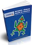
El análisis crítico de la red de monitoreo de los recursos hídricos de la Región de Tarapacá constituye un producto del proyecto titulado “Caracterización y Monitoreo de los Recursos Hídricos de la Región de Tarapacá”, financiado por el Fondo de Innovación para la Competitividad (FIC-R 2012) del Gobierno Regional de Tarapacá y ejecutado por el CIDERH. Este trabajo busca mejorar el monitoreo de los recursos hídricos de la región de Tarapacá realizando un diagnóstico detallado de la red de monitoreo de variables meteorológicas, fluviométricas, hidrogeológicas y de calidad del agua a cargo de la DGA. Este análisis crítico constituye el trabajo previo a la elaboración de una propuesta de red monitoreo que permita obtener datos fiables, representativos y en tiempo oportuno, con el fin de reducir el error en los estudios y proyectos y mejorar la gestión de los recursos hídricos de la región de Tarapacá.
Éditeur: Action Contre la Faim
Année 2007 | 785 pages | FRANÇAIS
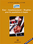
Ce manuel présente les méthodes et les techniques d’intervention essentielles à la réalisation de projets « eau et assainissement » : recherche d’eaux souterraines, forages, puits, captages de sources, réseaux de distribution gravitaire, traitement et distribution d’eau de surface, stockage d’eau de pluie, mais aussi infrastructures et mesures sanitaires, promotion de l’hygiène, développement des capacités locales.
Il valorise, au delà de l’approche technique pure, une stratégie d’intervention raisonnée et concertée dans le secteur de l’eau et de l’assainissement, valorisant l’impact, la pertinence, la cohérence et surtout la pérennité des projets à travers une gestion locale.
Éditeur: Action Contre la Faim
Année 2005 | 817 pages | Format PDF | 12,6 Mb | ANGLAIS
An instructional manual for both emergency and development settings, this authoritative book condenses ACF’s three decades of expertise in extending water and sanitation improvements to populations in need.


